Current Research
SHALLOW (NEAR TRENCH) SUBDUCTION ZONE MECHANICS
Fall 2022 - ongoing
I am currently working on understanding the seismic and tsunamigenic potential of shallow (near-trench) subduction zones. I use a combination of geophysical surveys, tectonogeomorphic mapping and structural analysis of the downgoing plate, accretionary prism, and forearc in the Japan Trench and Aleutian subduction zone. My main interests involve understanding what structures, stress regimes, fluid processes, sedimentology and the frictional processes that either restrict or permit propagation of rupture to reach shallow plate interfaces.
I am currently working on understanding the seismic and tsunamigenic potential of shallow (near-trench) subduction zones. I use a combination of geophysical surveys, tectonogeomorphic mapping and structural analysis of the downgoing plate, accretionary prism, and forearc in the Japan Trench and Aleutian subduction zone. My main interests involve understanding what structures, stress regimes, fluid processes, sedimentology and the frictional processes that either restrict or permit propagation of rupture to reach shallow plate interfaces.
Past Projects
PANAMINT VALLEY TRANSFER ZONE, ECSZ
|
Fall 2020 - Fall 2022
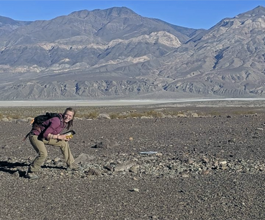
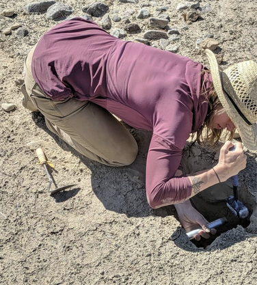
MS Thesis Research We investigated paleoseismic (Holocene) evidence for multi-fault and complex rupture in Panamint Valley, located ~50 km northeast of the 2019 Ridgecrest ruptures. We produced a 1:4k scale tectonogeomorphic map of the 40 km² area between the Ash Hill and Panamint Valley faults using a locally-calibrated relative-age alluvial fan chronology and using NCALM lidar DEMs and aerial imagery to identify ruptures. We bracketed earthquake timing with IRSL dating of offset deposits. We record vertical and lateral offsets at over 250+ locations using field mapping and backslipped reconstructions of newly generated high resolution (5 cm) drone-based structure from motion digital surface models. USGS EDMAP I produced a 1:12k scale map of the central Panamint Valley, including a compilation of prior mapping from Regalla et al. (2022) and Sethanant (2019). I employed GeMS standardized mapping techniques and worked with Andy Cyr, the Project Chief for the Neotectonics of the Northern Mojave Desert mapping effort, to produce a professional USGS-style map. This map won second place at the Best Student Geologic Map Competition at GSA 2022. |
|
MUSEUM FIRE SEISMIC MONITORING, FLAGSTAFF, AZ
Fall 2020
Wildfires are efficient at slope destabilization through a removal of vegetation and increased hydrophobicity of soil. After the 2019 Museum Fire in Flagstaff, AZ, slope destabilization and summer monsoons contributed to high landslide hazard risk on Mt. Elden. In order to examine the geophysical signature of the vibration energy produced from mass wasting, seismometers were deployed in the summer of 2019 and the summer of 2020. Under the supervision of Dr. Ryan Porter, I assisted in the monitoring of seismometers in the second field season. I was responsible for collection and processing of data in the second field season.
Wildfires are efficient at slope destabilization through a removal of vegetation and increased hydrophobicity of soil. After the 2019 Museum Fire in Flagstaff, AZ, slope destabilization and summer monsoons contributed to high landslide hazard risk on Mt. Elden. In order to examine the geophysical signature of the vibration energy produced from mass wasting, seismometers were deployed in the summer of 2019 and the summer of 2020. Under the supervision of Dr. Ryan Porter, I assisted in the monitoring of seismometers in the second field season. I was responsible for collection and processing of data in the second field season.
PUBLICATIONS, POSTERS, PRESENTATIONS
2022
- LaPlante, A., Regalla, C., Sethanant, I., Mahan, S. A., Gray, H. J. (2022). Quantifying modifications in Holocene alluvial fan morphology to determine paleoseismicity of the Panamint Valley transtensional relay (ECSZ). Oral Presentation at 2022 GSA Connects Annual Meeting.
- LaPlante, A., Regalla, C. (2022) Quaternary surficial mapping of central Panamint Valley to evaluate paleoseismic evidence for multi-fault rupture, Eastern California Shear Zone. Poster Presentation at 2022 GSA Connects Annual Meeting.
- LaPlante, A. A. (2022). Evidence for late holocene multi-fault rupture in the panamint valley transtensional relay, eastern california shear zone (Order No. 29322818). [Masters thesis, Northern Arizona University, 148 pp.] Available from ProQuest Dissertations & Theses Global. (2705435966).
- LaPlante, A., Regalla, C., & Sethanant, I. (2022, 09). Evidence for late Holocene multi-fault rupture in the Panamint Valley transtensional relay, Eastern California Shear Zone (ECSZ). Poster Presentation at 2022 SCEC Annual Meeting.
- Regalla, C., Kirby, E., Mahan, S., McDonald, E., Pangrcic, H., Binkley, A., Schottenfels, E., LaPlante, A., Sethanant, I., & Lynch, E. M. (2022). Late Holocene rupture history of the Ash Hill fault, Eastern California Shear Zone, and the potential for seismogenic strain transfer between nearby faults. Earth Surface Processes and Landforms. https://doi.org/10.1002/esp.5432
- LaPlante, A., & Regalla, C. (2021, 08). Tectonogeomorphic evidence for late Holocene complex rupture linking the Panamint Valley and Ash Hill faults, Eastern California Shear Zone. Poster Presentation at 2021 SCEC Annual Meeting.
- Porter, R., Joyal, T., Beers, R., Loverich, J., LaPlante, A., Spruell, J., Youberg, A., Schenk, E., Robichaud, P. R., & Springer, A. E. (2021). Seismic Monitoring of Post-wildfire Debris Flows Following the 2019 Museum Fire, Arizona. Frontiers in Earth Science, 9, [649938]. https://doi.org/10.3389/feart.2021.649938
